Wake up daily to our latest coverage of business done better, directly in your inbox.
Get your weekly dose of analysis on rising corporate activism.
The best of solutions journalism in the sustainability space, published monthly.
Select Newsletter
By signing up you agree to our privacy policy. You can opt out anytime.
A Map of the Fastest Pathways to Replenish Groundwater in California's Central Valley
Depleted groundwater poses a serious threat to communities and farms in California's Central Valley, but scientists say the region's cropland might also be critical for refilling the underground aquifers holding that water.
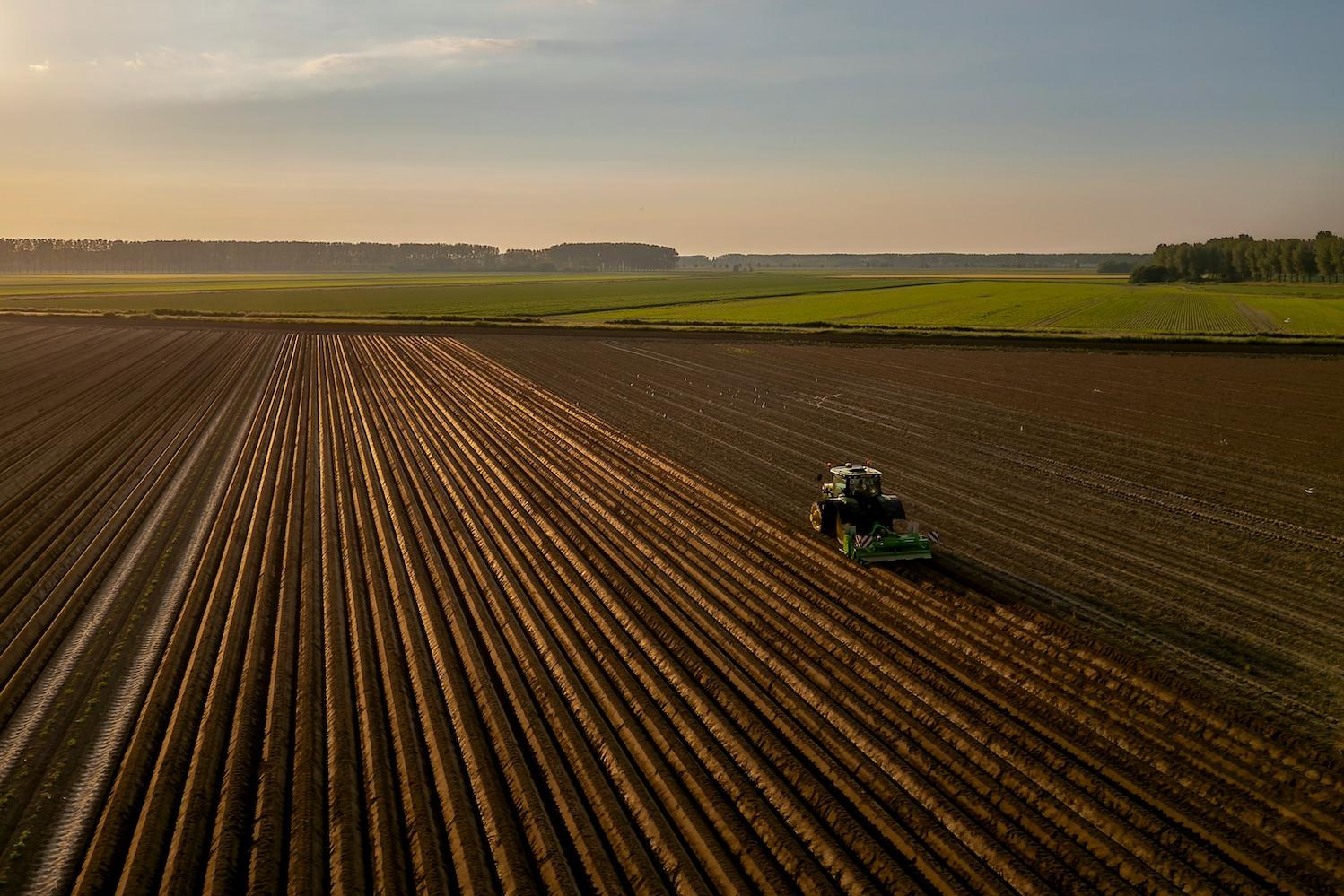
(Image: Tom De Decker/Unsplash)
The rich, fertile soil of California’s Central Valley is one of the most productive agricultural regions on the planet, producing about a quarter of the nation’s food supply annually. Much of that productivity relies on groundwater.
During an average year, 43 percent of the freshwater used for domestic and irrigational purposes in the Central Valley comes from groundwater, rising to 70 percent in drought years, according to the United States Geological Survey. The Central Valley contains 75 percent of the irrigated land in California and 17 percent of all the irrigated land in the U.S. Because of overuse, groundwater levels declined significantly over the last century. Now, the region's cropland may be critical for refilling groundwater reservoir, according to a new report by Stanford University scientists.
“When surface water supplies run low during droughts, people turn to pumping groundwater,” Seogi Kang, a former post-doctoral fellow at Stanford and co-author of the report, told TriplePundit. “The problem is groundwater is finite. We’ve been over-pumping it for decades, and natural recharge from precipitation can’t keep up.”
To determine the Central Valley’s groundwater recharge potential, the Stanford team analyzed electromagnetic data collected by a helicopter-borne sensor that surveyed over 12,000 miles of the region. The sensor creates a magnetic field, which induces an electrical current in the ground, said Kang, now assistant professor at the University of Manitoba. The current behaves differently depending on the soil and sediment below, allowing the researchers to map it.
“Clay conducts electricity well, while sand and gravel resist it,” Kang said. “So we can build a 3D model of the subsurface, which helps us understand where water can infiltrate or be stored.”
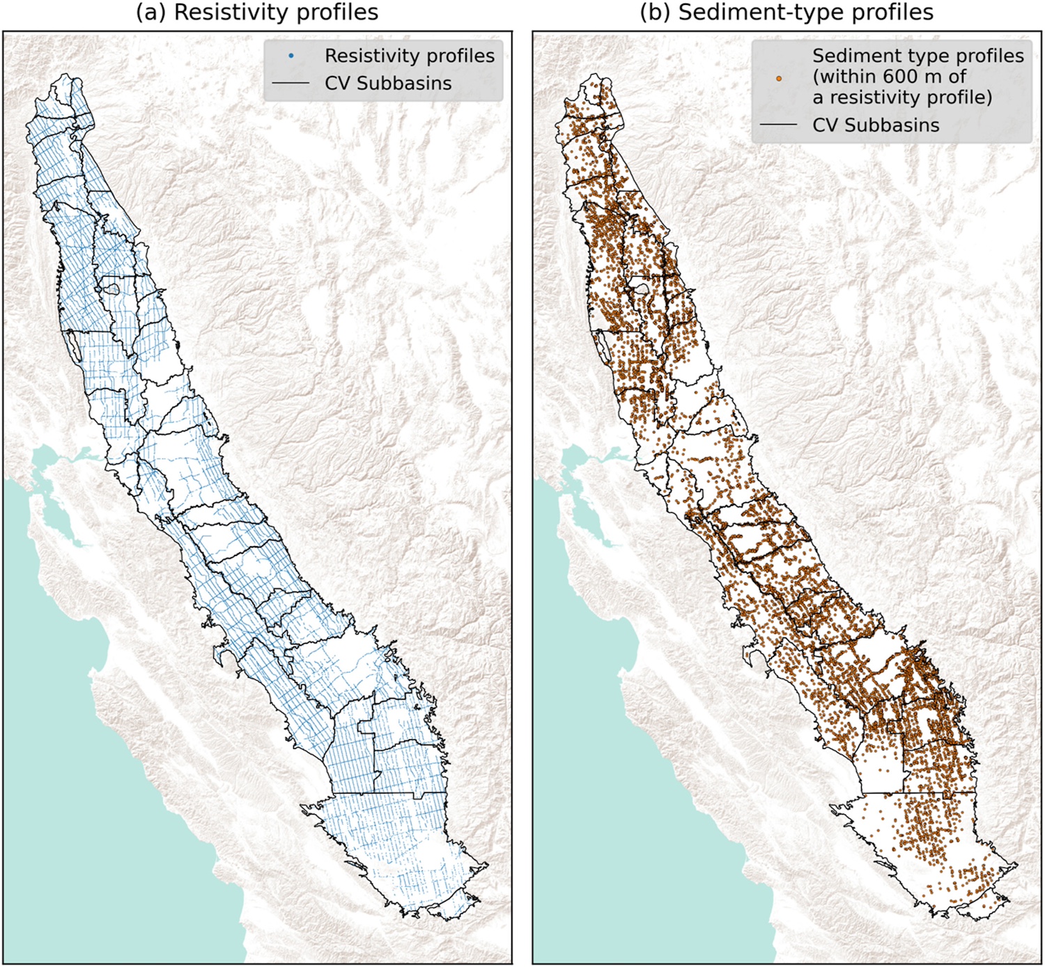
They found that as much as 13 million acres of the Central Valley may be suitable for groundwater recharge. The largest portion of which is agricultural land, especially orchards, crop fields and vineyards.
“About 70 percent of the Central Valley is cropland, so naturally, much of the suitable area overlaps with agriculture,” Kang said. “If you want to recharge groundwater at scale, it makes sense to start with the land that dominates the region.”
The concept of replenishing groundwater is called managed aquifer recharge. Water left sitting on the surface during periods of excess, such as after rainstorms or snowmelt, is diverted to an area where it can seep underground. When moved to a more absorbent area, the water travels down through connected pathways of sand and gravel, eventually reaching natural underground reservoirs called aquifers.
Diverting water away from areas where it's not absorbed it is also essential to avoid damaging crops. “Farmers won’t want to participate if their crops are at risk," Kang said. "Also, soil types matter. If the surface contains a lot of clay, water might pond and not infiltrate."
To help restore balance, water agencies in the valley are looking for places to replenish groundwater using excess surface water available during wet years.
“Instead of letting that water run off or evaporate, you direct it to recharge zones where it can infiltrate the ground and replenish the aquifer,” Kang said. “The challenge is knowing when and where that excess water is available and identifying the best places for it to percolate underground.”
Recharging groundwater is much slower than pumping it to use above ground because recharging relies on gravity and the water naturally seeping from the surface through the ground to the aquifer, which can be up to 50 meters deep in the Central Valley.
“Once water reaches the aquifer, it still needs time to spread out and fill available pore space,” Kang said. “Injection wells can speed things up, but they’re expensive and require permits, so scaling that method is limited.”
Stanford’s Sustainability Accelerator program developed an online tool called Fastpath to make the data publicly accessible. Now, anyone can use it for groundwater recharge planning.
“We worked closely with local and federal agencies to make sure it met their needs. Users can go to the website, select a region — like a sub-basin — and view available data such as well locations or geophysical survey coverage,” Kang said. “If they don’t have any data in an area, it’s probably not useful. But if data exists, they can run analytics to identify recharge potential.”
Moving forward, Kang is optimistic about using geophysical data like this in other helpful ways.
“One motivation for this project was seeing that a lot of publicly funded geophysical data just sits unused after it’s collected. Our goal was to show that you can take that data and turn it into something useful,” Kang said. “I’ve already seen similar efforts emerging, so I think we’ve helped spark new ways of thinking in the research community.”
Editor's note: An earlier version of this story referred to Fastpath by an incorrect name. We regret the error.
Gary E. Frank is a writer with more than 30 years of experience encompassing journalism, marketing, media relations, speech writing, university communications and corporate communications.


